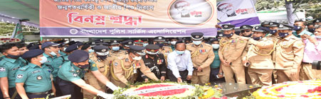
- The Government of the Peoples Republic of Bangladesh

City Guide
Dhaka is the capital of Bangladesh and the principal city of Dhaka District. Located on the banks of the Buriganga River, Dhaka, along with its metropolitan area, has a population of 11 million, making it the largest city in Bangladesh.
Dhaka is located in central Bangladesh at 23°42'0"N, 90°22'30"E, on the eastern banks of the Buriganga River. The city lies on the lower reaches of the Ganges Delta and covers a total area of 815.85 square kilometres (315 sq mi). It consists of seven principal thanas — Dhanmondi, Kotwali, Motijheel, Paltan, Ramna, Mohammadpur, Sutrapur, Tejgaon — and 14 auxiliary thanas — Gulshan, Lalbagh, Mirpur, Pallabi, Sabujbagh, Dhaka Cantonment, Demra, Hazaribagh, Shyampur, Badda, Kafrul, Kamrangir char, Khilgaon and Uttara. In total the city has 130 wards and 725 mohallas. Dhaka district has an area of 1463.60 square kilometres (565 sq mi); and is bounded by the districts of Gazipur, Tangail, Munshiganj, Rajbari, Narayanganj, Manikganj. Tropical vegetation and moist soils characterise the land, which is flat and close to sea level. This leaves Dhaka susceptible to flooding during the monsoon seasons owing to heavy rainfall and cyclones.
Dhaka experiences a hot, wet and humid tropical climate. The city is within the monsoon climate zone, with an annual average temperature of 25 °C (77 °F) and monthly means varying between 18 °C (64 °F) in January and 29 °C (84 °F) in August. Nearly 80% of the annual average rainfall of 1,854 millimetres (73 in) occurs between May and September. The environment of Dhaka is facing serious threats from pollution caused by the city's rapid expansion, congestion and industrial activities. Increasing air and water pollution emanating from traffic congestion and industrial waste are serious problems affecting public health and the quality of life in the city. Water bodies and wetlands around Dhaka are facing extinction as these are being filled up to construct multi-storied buildings and other real estate developments.

Cycle rickshaws and auto rickshaws are the main mode of transport for the inhabitants of the city, with close to 400,000 rickshaws running each day — the largest number for any city in the world. However, only about 80,000 rickshaws are licensed by the city government. Relatively low-cost and non-polluting cycle rickshaws nevertheless cause traffic congestion and have been banned from many parts of the city. Public buses are operated by the state-run Bangladesh Road Transport Corporation (BRTC) and by private companies and operators. Scooters, taxis and privately-owned automobiles are increasingly becoming popular with the city's growing middle-class. The government has overseen the replacement of two-stroke engine taxis with "Green taxis" locally called CNG, which run on compressed natural gas.
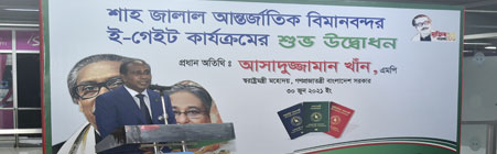
Dhaka has 1,868 kilometres (1,161 mi) of paved roads. It is connected by highways and railway links to Chittagong, Khulna, Mymensingh, Rajshahi, Faridpur and Sylhet. Highway links to the Indian cities of Kolkata and Agartala have been established by the BRTC which also runs regular bus services to those cities from Dhaka. The Kamalapur Railway Station and the Airport (Biman Bandar) Railway Station are the main railway stations providing trains on suburban and national routes operated by the state-run Bangladesh Railway.[citation needed] The Sadarghat Port on the banks of the Buriganga River serves the transportation of goods and passengers upriver and to other ports in Bangladesh and South Asia.[citation needed] The Hazrat Shahjalal International Airport (HSIA) is the largest and busiest in the nation.[citation needed] The state-run Biman Bangladesh Airlines is the primary airline corporation based at the airport, although private carriers are gaining popularity.